Menu bar
The menu bar consists of the following entries:

ODIN-C2IS
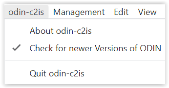
If you have activated the function "Check for new Versions ", ODIN checks after every start, if there is a new version available on the homepage of ODIN (https://odin.syncpoint.io/).
If this is the case, a window appears, in which you have the possibility to update your ODIN version to the new version or to continue working with the previous version:
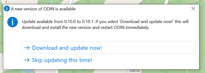
If you confirm that ODIN should be updated, you don't have to do anything else but wait until ODIN closes the previous version and restarts with the current version. The current settings (project, layer, map section etc.) are preserved after the restart.
Management
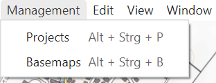
With selection of "Projects " you open the project administration, in which you can create, rename, delete, export, import projects or switch to another project (details see project administration).
Selecting "Base maps " opens the "Map administration", where you can integrate online and offline maps and use them in ODIN (details see Map administration).
Edit
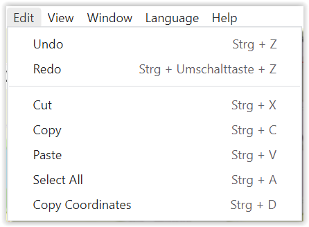
The typical Windows functionalities are shown here. These are also available from the Activity Bar.
With function "Copy Coordinates " (STRG + D) you can copy coordinates in the format "Longitude/Latitude" (military: right value/high value) as follows:
- No symbol marked on map: Coordinate of mouse pointer;
-
Point symbol marked on map: Coordinate of point symbol (= red point);
-
Multipoint symbol (line, space): All coordinates of multipoint symbol (= points set by user).
For following objects, copying coordinates is not possible, because due to the complex geometry it may not be clear to user from which coordinates the representation form of geometry results:
- Area, circular (e.g. ACA, FSA, NFA);
- tactical graphics, 2-point fan (e.g., Occupy, Isolate);
- tactical graphics, 3-point fan (e.g., Bypass, Canalize);
- tactical graphics, orbit (e.g., Delay, Withdraw);
- tactical graphics, corridor (e.g. CATK, SAAFR, Main Attack).
View

The function "Toogle Developer Tools " is only relevant if there are problems in usage and you need support. Then it may be that we will ask you to provide us with more information given there.
With "Zoom In " (STRG + SHIFT + =) and "Zoom Out " (STRG + -) the display area of the map itself, but also the displays on it (e.g. activity bar, scale, project/layer name etc.) can be zoomed in or out. With "Original size" (STRG + 0) you can return to ODIN's default setting, e.g. 100%
 |
 |
 |
|---|---|---|
| (zoomed in) | (original size) | (zoomed out) |
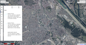
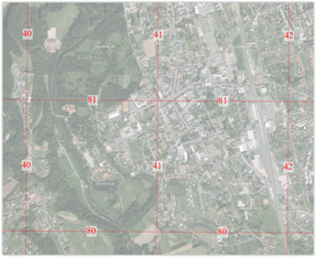
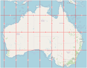
With function "MGRS Graticule" you can show or hide a MGRS (Military Grid Reference System) grid on all your maps used in ODIN (e.g. also on orthophoto maps) worldwide:
 |
 |
|---|---|
With function "Labels " you can choose in ODIN if the modifiers should be shown with the features on the map or not. Note that above a certain scale, labels are never shown.
 |
 |
|---|---|
| (labels shown) | (labels hidden) |
Window
Language
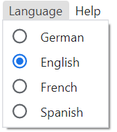
Here you can switch the display of the functions, tool tips etc., which concern the user interface between "German", "English", "French" and "Spanish".
Help
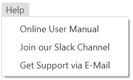
If you need help in using ODIN, you can choose between the following supports here:
With function "Online User Manual" you can access the user manual of the current published version of ODIN.
With "Join our Slack Channel" or "Get support via e-mail" functions, you can contact us directly via Slack or e-mail for support in case of a problem in ODIN.
In the Slack area you can also send us your feedback or change requests to ODIN. Furthermore we publish in this area also the respective information, what has changed in the each update to ODIN compared to the previous version.